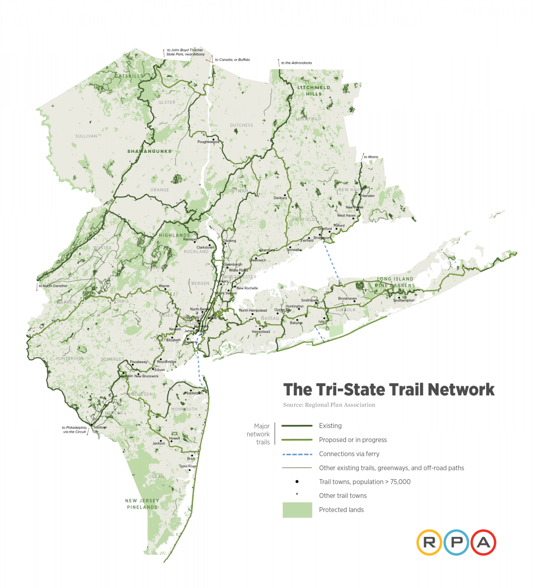
Regional Plan Association released a report entitled Accessing Nature which outlines how New York, New Jersey, and Connecticut can become leaders in connecting residents with the region’s natural beauty and recreational activities. The report recommends existing and proposed trail routes to be prioritized and built to create one of the nation’s largest regional trails networks. The system would make trail access more equitable, putting over 80% of the region’s current residents within two miles of a trail and facilitating access to 141 local, state and national parks or preserves by joining the region’s trails into a continuous network.
Building the Tri-State Trail network will promote health, equity, the environment, and economic activity throughout the region. Access to green space has many proven health benefits, including decreased rates of depression and obesity. The Tri-State Trail will also create safe routes for natural migration while reducing the need for car travel and associated carbon emissions for residents to visit natural areas. Low income residents, disproportionately without cars, people with disabilities and bike riders will particularly benefit from expanded access to the region’s natural assets. Additionally, the network will create economic development and tourism opportunities, especially in towns and cities that currently have limited or no public transportation options.
The report also calls for building off of decades of work done by local and national organizations as well as local municipalities that have developed over 800 miles of the 1,650-mile network already. The concept would link existing trails and trails currently under construction – such as the Harbor Ring, Morris Canal Greenway, Merritt Parkway Trail, and Empire State Trail — and provide a larger vision to help unite local trails groups land trusts and federal, state, and local governments, and other community stakeholders to bring additional expertise and financial support to help expedite the development of these projects.
Read the full report